


READING Borough Council has released two new maps detailing walking and cycling routes around Reading to encourage active travel.
The walking map shows a number of routes for the best on-foot travel, including lesser-known footways and public rights of way in the borough.
It also includes a detailed map of the town centre, highlighting areas of historical and architectural interest and places to visit.
The cycling map shows the National Cycle Network and the major branded cycle routes through Reading, as well as bike storage and parking facilities, park and stride locations, and related safety information.
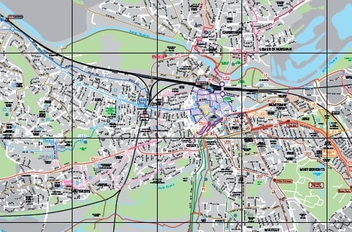
The maps are available as high-resolution PDF documents for printing at home, or can be collected from local libraries.
An interactive map is also available online via the Reading Borough Council website.
Cllr Tony Page, Reading Borough Council’s lead councillor for climate strategy and transport, said: “Walking or cycling instead of using the car has many benefits for our physical and mental wellbeing, the health of our local environment and our wallets.
“Bikes are the most energy-efficient form of transport and can be faster and more predictable than cars for short journeys.
“Cycling or walking regularly can keep you fit, save you money – no tax, no fuel, no fares – and it’s one of the most environmentally-friendly ways to travel.”
Cllr Page said that the maps are just one part of a wider range of initiatives aimed at supporting a shift in travel behaviour to active modes.
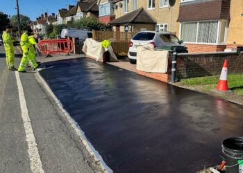
“We are creating more pedestrian and segregated cycle routes, and we are currently consulting local residents about the draft proposals for the Bath Road and Castle Hill segregated cycle lanes.
“We also have new cycle parking planned, including a new bike parking and advice hub in the centre of Reading.
“Good progress is being made with major sustainable travel investments like the new Green Park Station and the refurbished Reading West Station, for example, both due for completion this year.”
Riders can also plan cycle routes using the National Cycle Network via: www.sustrans.org.uk.
The interactive map is available via: my.reading.gov.uk.
The cycling map can be found at: www.reading.gov.uk.
The walking map can be found at: www.reading.gov.uk

